Current projects and activities
Below you'll find the plethora of fields of application of spatial data.
Through its internal or external partnerships and its own projects, the SCC supports various initiatives, all targeting a more sustainable and resilient tomorrow.

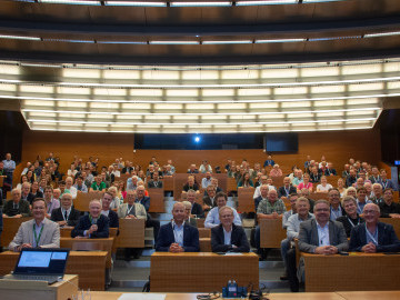
The GeoDay was a success
We had 33 participants online, including our own students from Vasa, and 32 on site in the morning session, 19 in our students seminar and 45 in our hands-on session - even though it was lecture week (what are the odds!)
Additionally to our presenters notably from GISPO, LUKE, SYKE, NSL, Novia UAS and even Royal Danish Academy, we had visitors from Nylands Svenska Lantbrukssällskap, Raseborg Energi, Raseborg Stad and students from Hangö, Ekenäs gymnasium (with teachers Axel Holmberg and Johanna von Frenckell) and visiting prospect students from Ostrobothnia. Also a big thank you to Västra Nyland museum and Lena Dahlberg for lending us the old maps of Ekenäs.

Case Västerby update
Many things happened over the last few months at Case Västerby to provide new insights on opportunities and threats after the clear cut of September:
- Following international students visit of the May, a report has been written and published
- The bird survey from our intern Senuri has been published
- Drone shots and analysis have been mapped
More info can be found at the dedicated
GeoAI
ETH Zürich hosted a symposium for the 100 years of the Institute of Cartography and Geoinformation and the SCC attended both days: Truly inspiring talks with central themes about AI in cartography, eye tracking, cognition, and the future of our discipline > a lot still rely on spatial literacy and trust - exactly what SCC is aiming to promote! https://ikg.ethz.ch/en/symposium-100-jahre.html
More details on the travelogue
Walking on sunshine
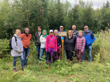
This August, the RDI team at Novia Raseborg walked the newly opened trail (press release and blog post) and enjoyed the diverse landscapes at sight. Project leader Anna-Karin Almén, partnering with two students from Sustainable Coastal Management and the SCC, worked most of the summer to create the official map of the paths, mark the trees, design and install the informative signs.
Slätberget nature trail now invites everyone to walk, run, jog, breathe, see, attend, share and enjoy.
You're not alone
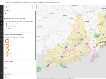
The CNE 2.0 project focused on sustainable tourism actors in Uusimaa, with focus on carbon footprint and emissions. The map gives an overview of responsible companies and destinations who already embarked on their journey towards sustainability and its overarching goal of getting the Sustainable Travel Finland label. The map is made for actors who want to hop in and helps them to see that "they're not alone" in that process, that there are others "around" to leverage on, to network with, to get inspired from.
Read the report
Read the blogpost
Haven't you heard?
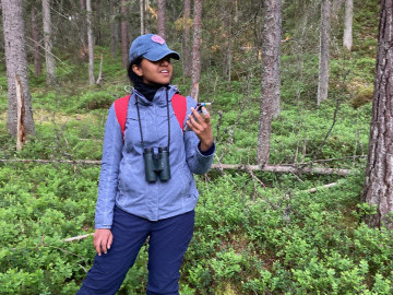
In the context of the Case Västerby and in close collaboration with Raseborgs stad, Sustainable Coastal Management teacher and student, we surveyed Västerby outdoor recreation centre in the early moment of the day for bird surveying. Along with placement of audiomoths, automated call and song recording devices, we will aim to study the area bird population and habitat.
GIS applications
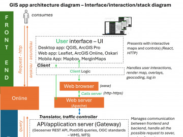
The SCC got the opportunity to teach for a full semester the GIS app course, part of the land surveying technology program in Vaasa. Whereas the program is in Swedish, the students managed to acquire the required level of competence even if the course was mostly given in English (also because of the intrinsic slang linked to the course itself). Working with students brings a lot of amazement.

Case Västerby
The SCC was on the field with students visiting in the framework of the Forest Regeneration course (skogsbruksingenjör) and of the Restoration Ecology Course from HZ University of Applied Sciences, Eesti Maaülikool/Estonian University of Life Sciences, and Raseborgs stad. Case Västerby aims at mitigating the negative effects and boost positive effects of the coming logging strategy (Raseborg City Forest Plan) in Raseborg Västerby recreational area. This was the second part of the project, the first part resulting in detailing a set of actions possible. Next steps are to include citizens of Raseborg, to submit their idea and/or opinion notably using the soon-to-be-launched app.

Carbon Neutral Experience - CNE 2.0
The SCC has been involved with, notably, sustainable communities and businesses in Åbo to support collaborators involved in the CNE 2.0 project that thrives in bringing tourism actors on to the sustainability path. The SCC got to map networks of synergies, identify routes, gaps and opportunities between responsible destinations and services (a.k.a. STF - Sustainable Travel Finland) and then to present a sketch of map to the Uusimaa municipalities involved with great feedback in beautiful Fiskars.

Marine Spatial Planning
(Take 2)
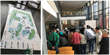
Second year of the TFK project (see post from a year ago) brought SCC in Zanzibar along with 6 students from Finland enrolled in the Sustainable Coastal Management bachelor program. We got to facilitate the MSP workshop organized around serious games (board game and online platforms) but guided by staff and students from State University of Zanzibar and Breda University of Applied Sciences.

Driving us places
What drives our field of expertise today lies in three interconnected pillars: digitalization, data collection and legislation. Spatial data are now collected by anyone, from anywhere, in real time and shared to the world via cloud services almost instantaneously. This created a plethora of new opportunities such as virtual reality and the digital twins that is recreating an entire space from the comfort of your chair, automation of tasks with artificial intelligence and machine learning or location-based services offering personal experiences on the spot when you want it where you want it. But also challenges linked to privacy and ethical guidelines, as we now can be anywhere and see everything through others sharing anything, all the time, should we really? This redefined our
Did you say dRoNe?
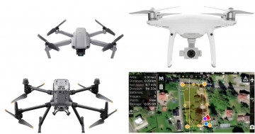
The SCC has access to an unmanned aircraft vehicle – UAV, a.k.a. drone – fleet (and respective licenses) granting capacity to accommodate a broad range of projects: DJI Mavic Air 2 for small and casual use; DJI Phantom 4 Pro for longer and more professional use; and DJI matrice 350, shared with Technobothnia, equipped with payloads specific for photogrammetry (orthophotos), Lidar (point cloud) and thermal. The SCC organizes workshops to learn how to manipulate the aircrafts and how to process the images with MapMadeEasy or WebODM.

It's GIS DAY
Every year on November 20 is GIS day. This day celebrates the geospatial progress and the constant crossing with latest technologies with events everywhere in the world. In the past, Novia has hosted GIS event and last year, the SCC participated in the Aarhus University GIS day in Denmark and their fantastic panel. November 20th, 2025, the SCC will host its own GIS day – spoiler alert, it will involve untraditional GIS users!
Maps are media
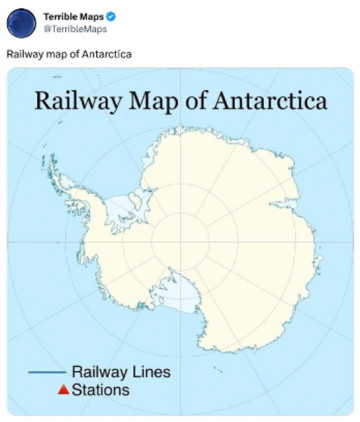
The SCC got the opportunity to showcase how magnificent, powerful, deceiving, dangerous, wonderful maps are during the IGU conference of Mediated geographies: Exploring the dynamic nexus of media, environment, and place in Jakobstad on October 2024. We unveiled the power of maps as open representation of perceptions, which defied the objective and stiff essence of mapping.
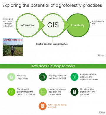
Workshop for agroforestry
The SCC got to host a QGIS workshop with Joshua Finch and the design team of the NylAF project. 7 farmers from Uusimaa gathered for a full day discovering, talking, understanding, wow-ing about GIS and spatial data. The workshop was part of the knowledge transfer toolkit the project is developing to support farmers getting acquainted with geospatial tools and assessing the feasibility of their agroforestry project.
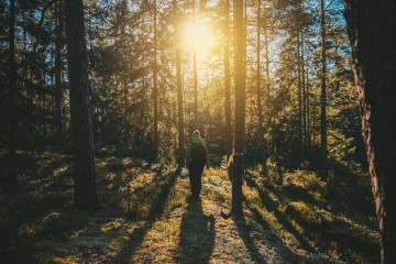
Tracking the path
The SCC was in the field with project leader Anna-Karin Almén to officially track the new nature trail - Slätbergets naturstig to come soon in Ingå. Using our DJI Mavic Air 2 drone and tracking app Avenza Maps, the trail twists and turns were captured and analyzed by our experts to untangle the best experience.
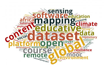
GeoICT4e
The SCC got the opportunity to meet some of the actors of this 4 year-project at the final seminar organized in Åbo. As Romi Rancken - Novia UAS was one of the partner, the SCC got mandated to create an innovative way to access the amazing repository created during the project: an interactive wordcloud, currently under development. Hopefully, this successful partnership will continue, further promoting impact-driven and socially innovative geospatial ICT education.

Resilience - you don't say
During our two-days yearly RDI bioeconomy seminar, the SCC showed to the crowd how spatial data contribute to facing current human challenges. By being accessible, understandable, connected, and fed to the latest technologies, spatial data provide
1. the ground base on which we stand to cope with changes - promoting resilience, and
2. give the context needed for better decision-making - supporting sustainability.
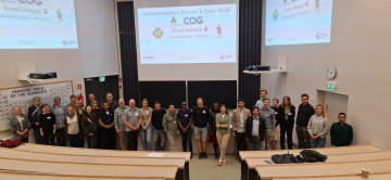
Networking is key
The SCC being part of a university of applied sciences makes its status peculiar and its involvement in regular networks (e.g. FUIGINET) complex. Nevertheless, the SCC attends national events such as Geoforum summit and regional events such as geoinformatics day and has now a Facebook account.

Renewable energies in the Nordics
The SCC and the Environmental Research Institute of UHI in Scotland had a busy month setting up the foundations of a future collaboration related to renewable energies and their challenges in terms of co-planning, co-management and coherence.
Read the
Marine Spatial Planning
The SCC got the opportunity to experience the MSP Challenge novel educational tool based on multi-layered platform for marine spatial planning in the context of Sustainable coastal management. The tool was developed by the Breda University of Applied Sciences (BUAS) and played by State University of Zanzibar (SUZA).

Passing on the knowledge
In the winter session, the SCC delivered an open online course about GIS in bioeconomy, focusing on basic concepts; and a live lecture about fields of application of geomatics with bachelors in sustainable coastal management in the context of their environmental impact assessment course - environmental consulting amongst them.
Modelling habitat preference
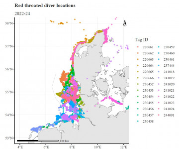
The SCC got involved with Stefan Heinänen in supporting the Individual-based model linked to the German Bight Red-throated divers. R is a vital resource to tidy and prepare the dataset to be used in the modelling and predicting the effect of windfarms and shipping on habitat preference and diving behaviour; but also for visualization.

Who knew spatial data were so hot right now
Novia identified the need to build permanent spatial data literacy and awareness to achieve its goals of bringing transformative approaches within its community to build resilience; the Spatial Competence Centre (SCC) was initiated as a development project to fill this need. The SCC has been designed as an internal transdisciplinary centre, allowing its integration in Novia diverse portfolio whether it is in traditional fields such as bioeconomy or technics but also in business, culture and health.
